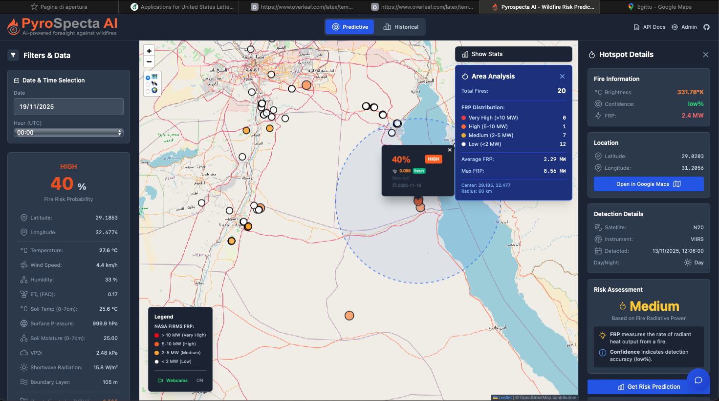
Wildfire detection software

Giving you the power to detect, alert, and respond before things get out of control.
PYROSPECTA-AI Detection System
Intelligent Wildfire Detection & Monitoring Platform
Version 2.0 Professional
System Overview
PYROSPECTA-AI represents excellence in early wildfire detection, combining thermal imaging, optical cameras, and artificial intelligence to identify fires in their initial stages, enabling rapid emergency response.
The system operates from observation towers equipped with PTZ (Pan-Tilt-Zoom) cameras, providing 24/7 automated surveillance over vast forest areas with detection ranges up to 15 kilometers in optimal conditions.
Key Features
AI Multi-Modal Detection
YOLOv8 neural network will be trained with more then 500,000 fire images, and will be combined with advanced thermal analysis for maximum accuracy.
RT Real-Time Monitoring
Live video feeds from thermal and optical cameras with detection latency under 3 seconds from event occurrence.
ALERT Intelligent Alerts
Multi-channel notifications (SMS, email, phone, push) with automatic escalation to ensure immediate response.
GPS Precise Geolocation
Automatic GPS coordinate calculation of fire location with accuracy under 5 meters at 10km distance.
DATA Analytics Dashboard
Real-time statistics, detection logs, performance metrics and advanced reporting capabilities.
PTZ Remote Control
Manual camera control with preset positions for targeted monitoring of critical areas.
System Performance
How It Works - Detection Pipeline
Image Acquisition
Dual cameras (thermal + optical) capture synchronized frames at 30 FPS. The thermal camera detects heat signatures while the optical camera provides visual confirmation.
AI Analysis
YOLOv8 neural network analyzes each frame, identifying flames, smoke, embers, and heat plumes. Thermal CNN processes infrared data to detect hotspots with temperature anomalies >5°C above baseline.
Sensor Fusion
Data from both cameras is combined using sensor fusion algorithms, cross-validating detections to increase confidence and reduce false positives.
Temporal Validation
System tracks detections across 3-10 consecutive frames to ensure persistence and filter out transient phenomena like reflections or birds.
False Positive Filtering
Multi-stage validation checks weather context, historical patterns, spatial coherence, and known heat sources to eliminate false alarms. Target: <5% false positive rate.
Geolocation Calculation
Using camera angles (pan/tilt/zoom), Digital Elevation Model (DEM), and triangulation, the system calculates precise GPS coordinates of the fire location.
Alert Dispatch
Multi-channel emergency notifications sent via SMS, email, phone calls, and push notifications to fire departments, operators, and emergency services with automatic escalation.
Technology Stack
Frontend Dashboard
AI & Detection
Hardware
Backend Services
Infrastructure
Integration
Benefits & Impact
Identifies fires in their initial stages when they are small and easily controllable, preventing potential disasters.
Dramatically reduces firefighting costs and property damage through rapid, targeted interventions.
Protects lives, property, wildlife, and natural resources through 24/7 automated surveillance.
PYROSPECTA-AI: Protecting Forests with Intelligence
Advanced AI technology for early wildfire detection and rapid emergency response
Request Information